About Taylor Wimpey
Taylor Wimpey was formed by the merger of George Wimpey and Taylor Woodrow in 2007. With a history dating back to the 19th Century, Taylor Wimpey is one of the largest homebuilders in the UK. Our aim is to be the nation’s leading residential developer for creating value and delivering quality. We are passionate about working with local people, businesses, local authorities and our customers to build aspirational homes.
Find you more about Taylor Wimpey at www.taylorwimpey.co.uk.
The site
The circa 7.5 hectare (ha) site is located on the south-western edge of Shipston-on-Stour, immediately south of Hanson Avenue. It is currently comprised of a number of field parcels which are of relatively low biodiversity value.
The field parcels are bounded by existing hedgerows and trees which represent more valuable habitats and which are to be retained as much as possible as part of the development proposals.
The site has a moderate slope that runs generally upwards from north to south away from the settlement of Shipston.
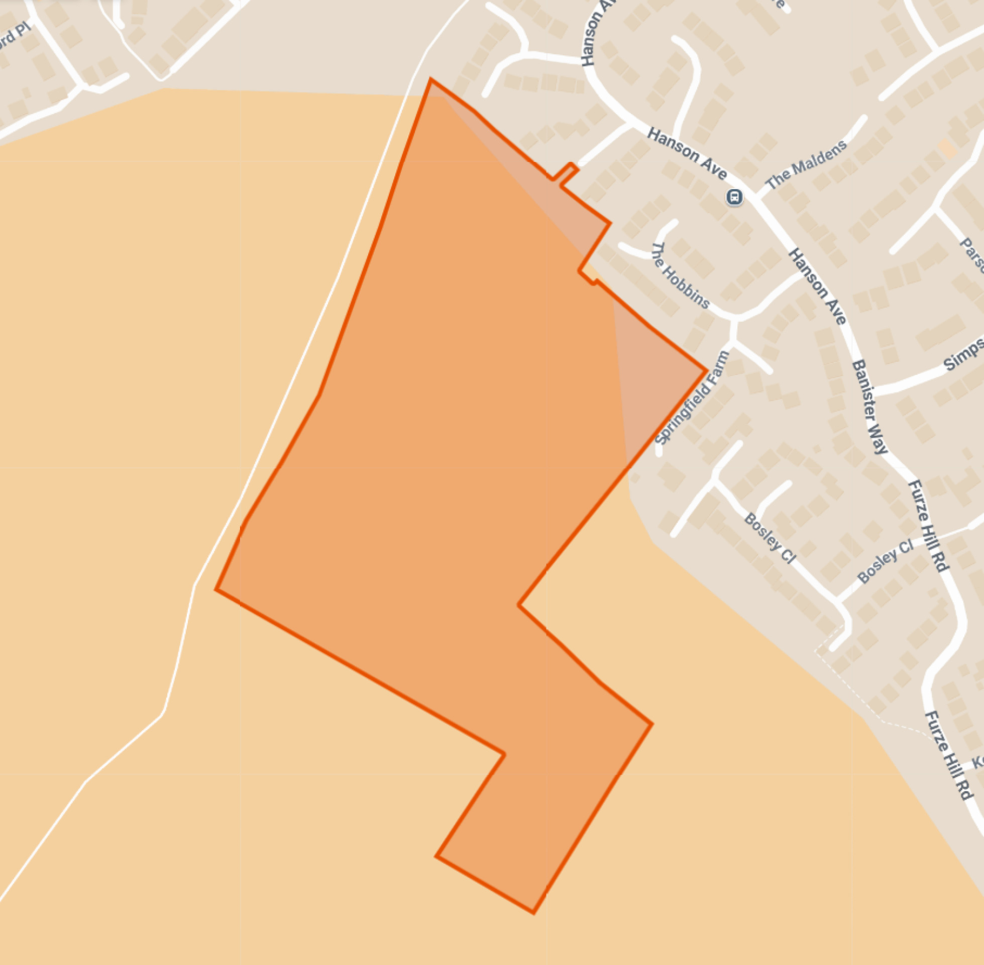
Site location plan - click to enlarge
Planning policy context
The site is located outside the green belt and occupies a highly sustainable location on the edge of the settlement boundary of Shipston-on-Stour. As such, it is being promoted through the emerging South Warwickshire Local Plan.
Increased housing targets for Stratford-on-Avon District
Changes to the National Planning Policy Framework (NPPF) announced by the Government in late 2024 has more than doubled the number of homes Stratford-on-Avon District will need to deliver from 553 to 1,126 homes per year.

South Warwickshire Local Plan
Local planning authorities are required by the Government to update their Local Plans every five years. The current development plan for Stratford-on-Avon District was adopted in July 2016 and has now fallen significantly out of date. Stratford-on-Avon District Council has acknowledged it needs to prepare a new local plan which it is preparing jointly with Warwick District Council through the emerging new South Warwickshire Local Plan.
In January 2025 the Council published its ‘preferred options’ which identifies a number of potential Strategic Growth Locations (SGL). The site off Hanson Avenue forms part of a wider SGL identified within the emerging Local Plan preferred options.
The Council’s next stage of consultation (Regulation 19) is scheduled for December 2025.
In light of the significantly increased housing targets for the district, Taylor Wimpey is preparing outline plans for the site alongside the ongoing process of preparing the local plan. This will help to ensure the delivery of homes at an early stage in the plan period, assisting Stratford-on-Avon District Council in maintaining housing supply to meet identified needs.
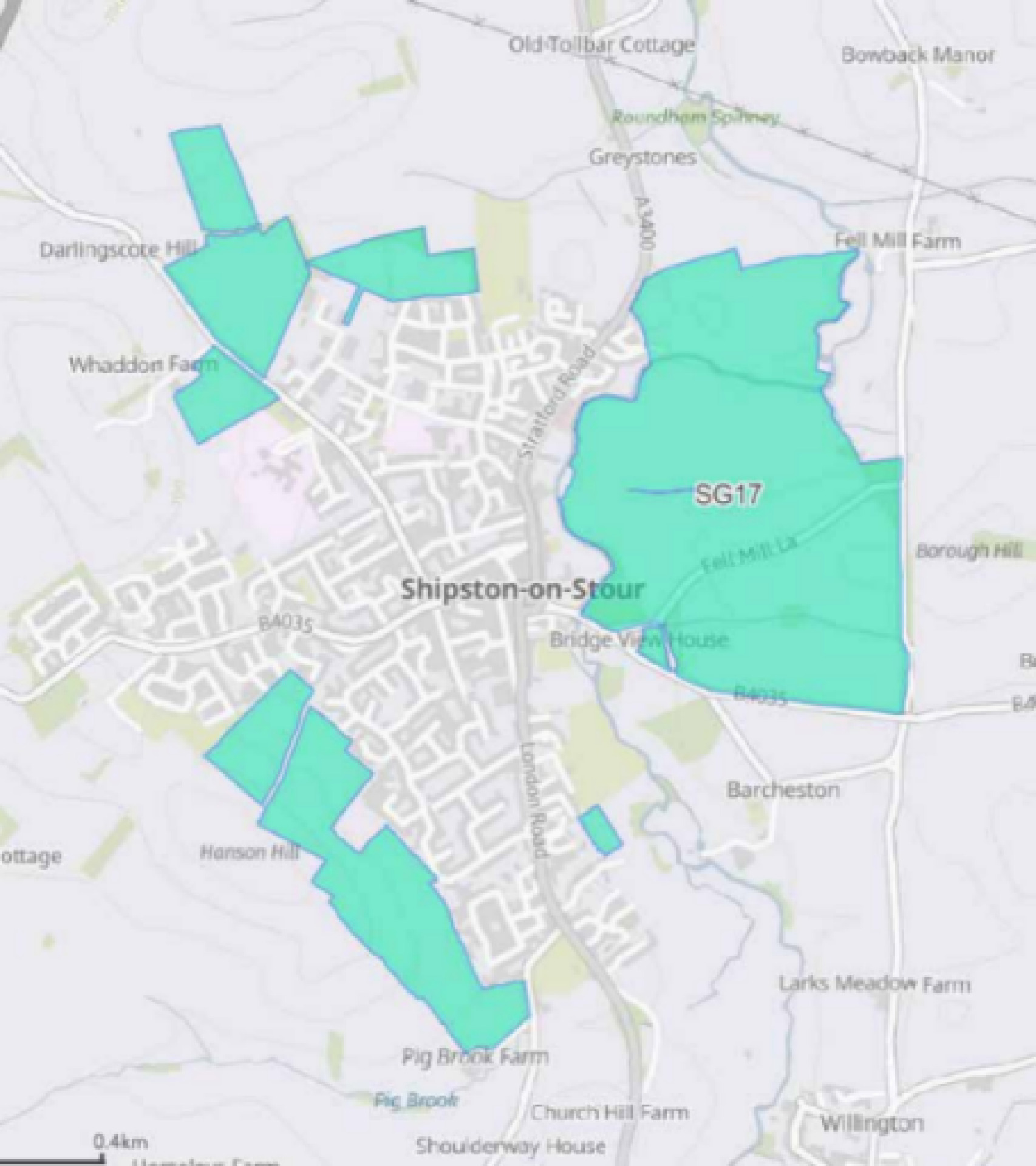
The site shown as part of a wider Strategic Growth Location in the Regulation 18 version of the emerging South Warwickshire Local Plan.
Shipston-on-Stour Neighbourhood Plan
Shipston-on-Stour Neighbourhood Plan is a locally produced document, that was adopted in 2018. The neighbourhood plan identified a small site to the immediate north of the site at Hanson Avenue under Policy HSG5 ‘Proposed Housing Opportunity from 2021’. This Neighbourhood Plan allocated site is subject to a current planning application 24/00303/OUT for 34 dwellings.
Local Plans are the key documents through which local planning authorities set out a vision and framework for the future development of the area, engaging with their communities in doing so. Local Plans address needs and opportunities in relation to housing, the local economy, community facilities and infrastructure. The Local Plan provides a degree of certainty for communities, businesses and investors, and a framework for guiding decisions on individual planning applications.
Local planning authorities, such as Stratford-on-Avon District Council, have a statutory responsibility to maintain an up-to-date Local Plan, and national policy indicates that Local Plans should be regularly reviewed, with the expectation this is done at least every five years.
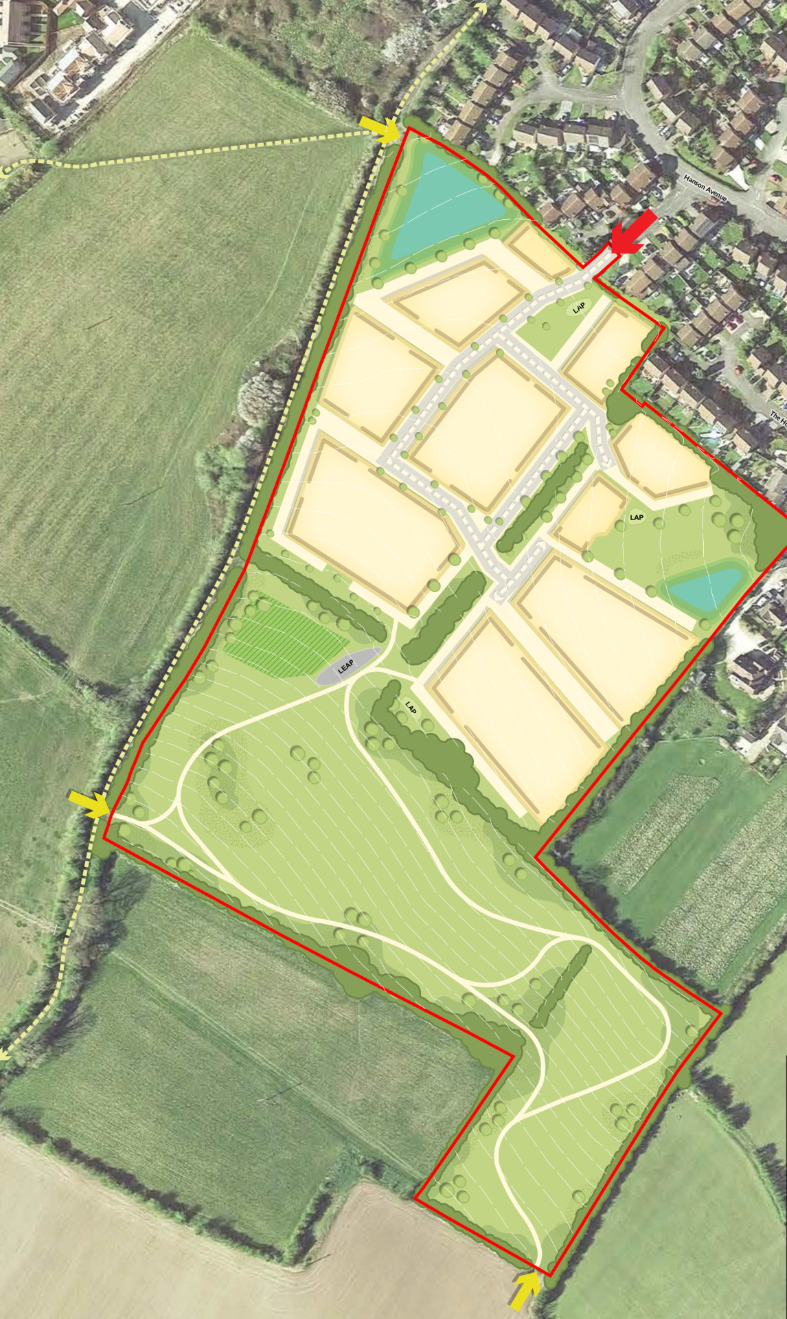
Site constraints and opportunities
How local features and landscape have shaped the proposed illustrative layout of the new neighbourhood.
In preparing the concept layout for the site, the technical team appointed by Taylor Wimpey first of all considered the landscape, drainage features, topography and local context of the site.
The following plan shows some of the features and constraints that have informed the emerging outline proposals. Key features include a public right of way running alongside the western boundary, existing trees and hedgerows, overhead power lines and localised areas of surface water flood risk, as well as neighbouring properties to the north and east.
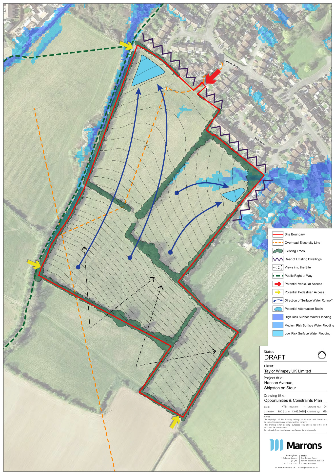
This plan shows an early analysis of some of the site features that have influenced the evolving masterplan for the site - click to enlarge
The outline vision for new homes and extensive green public open space
Taylor Wimpey is preparing an outline planning application for a sustainable new neighbourhood at the site south of Hanson Avenue, including:
- Approximately 110 high-quality family homes in a range of sizes and styles.
- Up to 35% of the new homes will be affordable.
- Affordable housing will include shared ownership homes for first time buyers.
- Scope to provide accessible homes for local people looking to downsize into a more manageable property.
- A significant proportion of the site retained as extensive landscaped open space, including biodiversity areas.
- A range of outdoor recreational facilities including children’s play areas and a network of new walking routes, as well as pedestrian connections to existing rights of way nearby.
- A development shaped by existing field patterns, with the retention of existing trees and the majority of hedgerows bolstered by extensive new planting to significantly increase tree cover across the site.
- Potential investment to support local infrastructure. This will be informed by feedback from statutory consultees such as the NHS Integrated Care Board, local education teams and highways authority.
The illustrative concept layout for the new neighbourhood. Click to open interactive map
New homes
House types
The planning application is an outline planning application. This type of planning application sets out the broad principles of development, such as the maximum number of homes, an illustrative layout and site access arrangements. Should outline planning permission be received, finer details such as specific house types, detailed layout, architecture etc would be subject to a subsequent further planning application (called a reserved matters planning application). This would involve further consultation with the community.
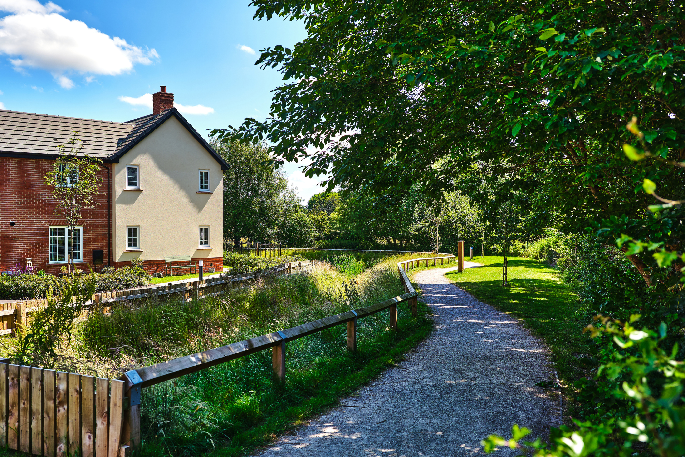
While house types would be determined at the reserved matters planning stage, we have provided imagery of existing Taylor Wimpey developments on this website to provide an idea of the types of high-quality homes we build.
Use the feedback questionnaire to tell us the types of homes you would like to see prioritised in Shipston-on-Stour.
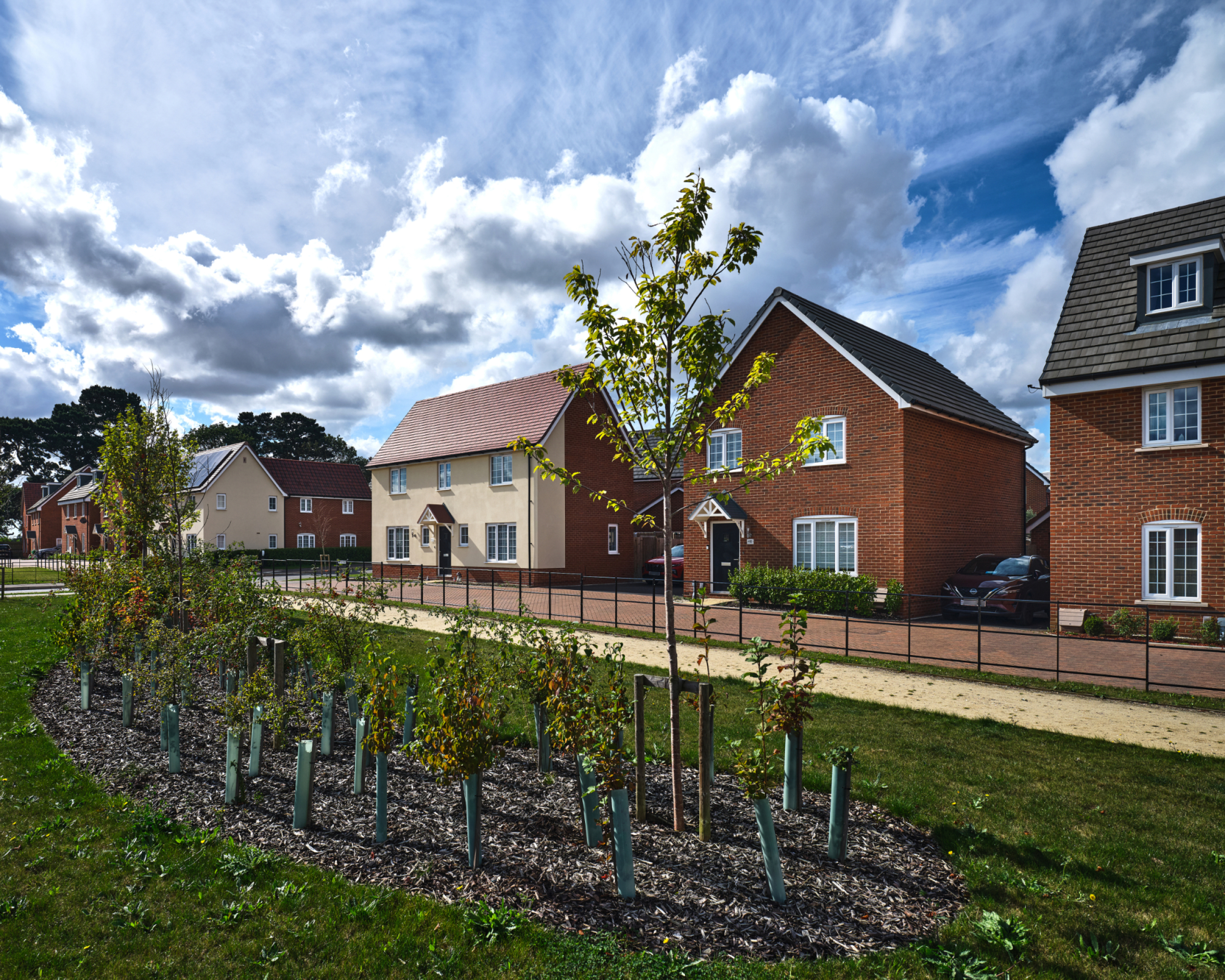
Examples of existing Taylor Wimpey developments. Click to open image gallery
Sustainable homes
At Taylor Wimpey, our purpose is to build great homes and create thriving communities. We are embedding sustainability across our business, delivering high-quality homes and places where customers can enjoy a good quality of life and adopt a more sustainable lifestyle.
It is envisaged that our new neighbourhood off Hanson Avenue will provide energy-efficient homes built to the Future Homes Standard. This will see all homes equipped with air source heat pumps, PV (solar) panels, EV charging infrastructure and very high standards of insulation.
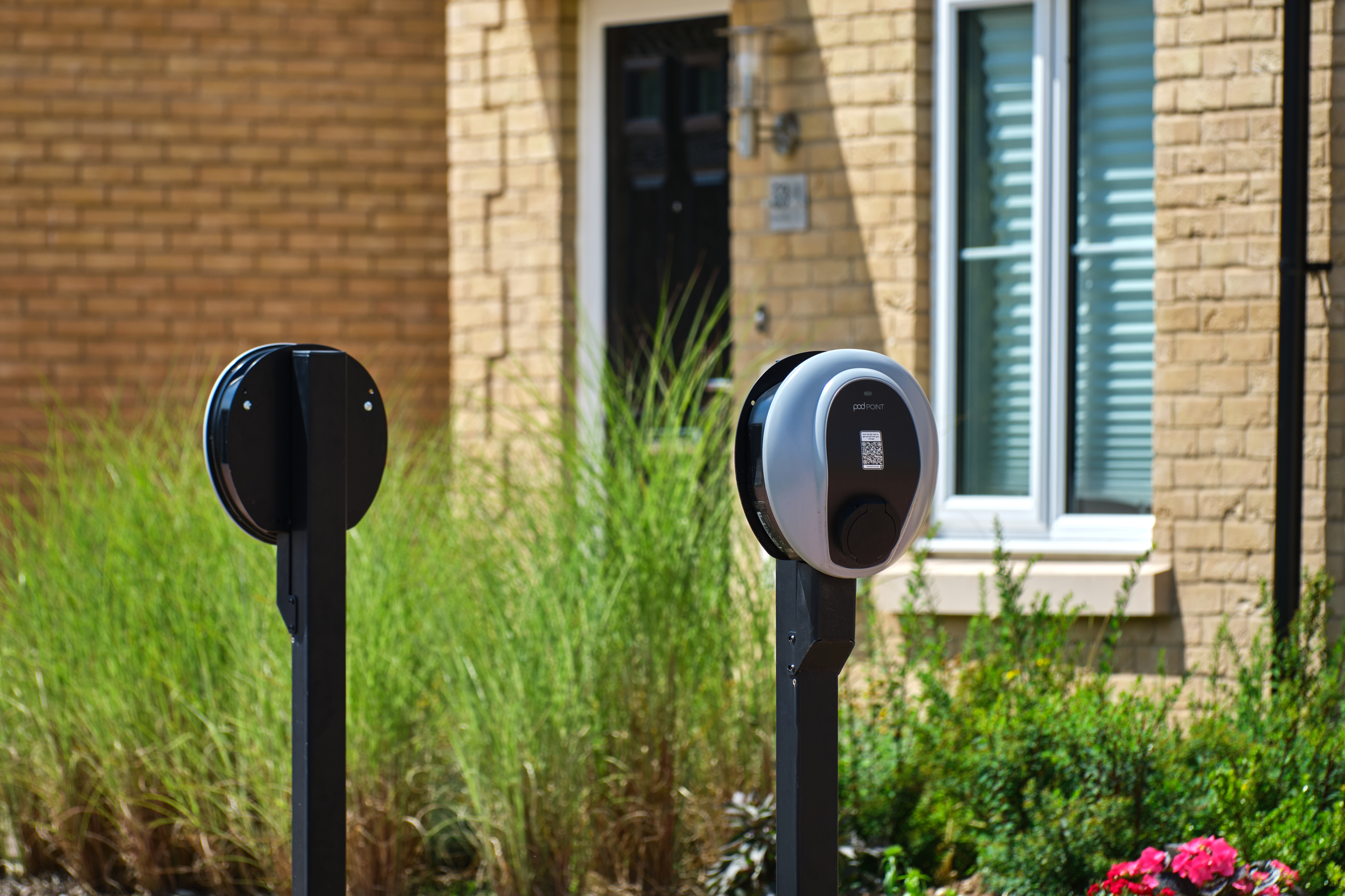
The new homes in Shipston-on-Stour will be low carbon.
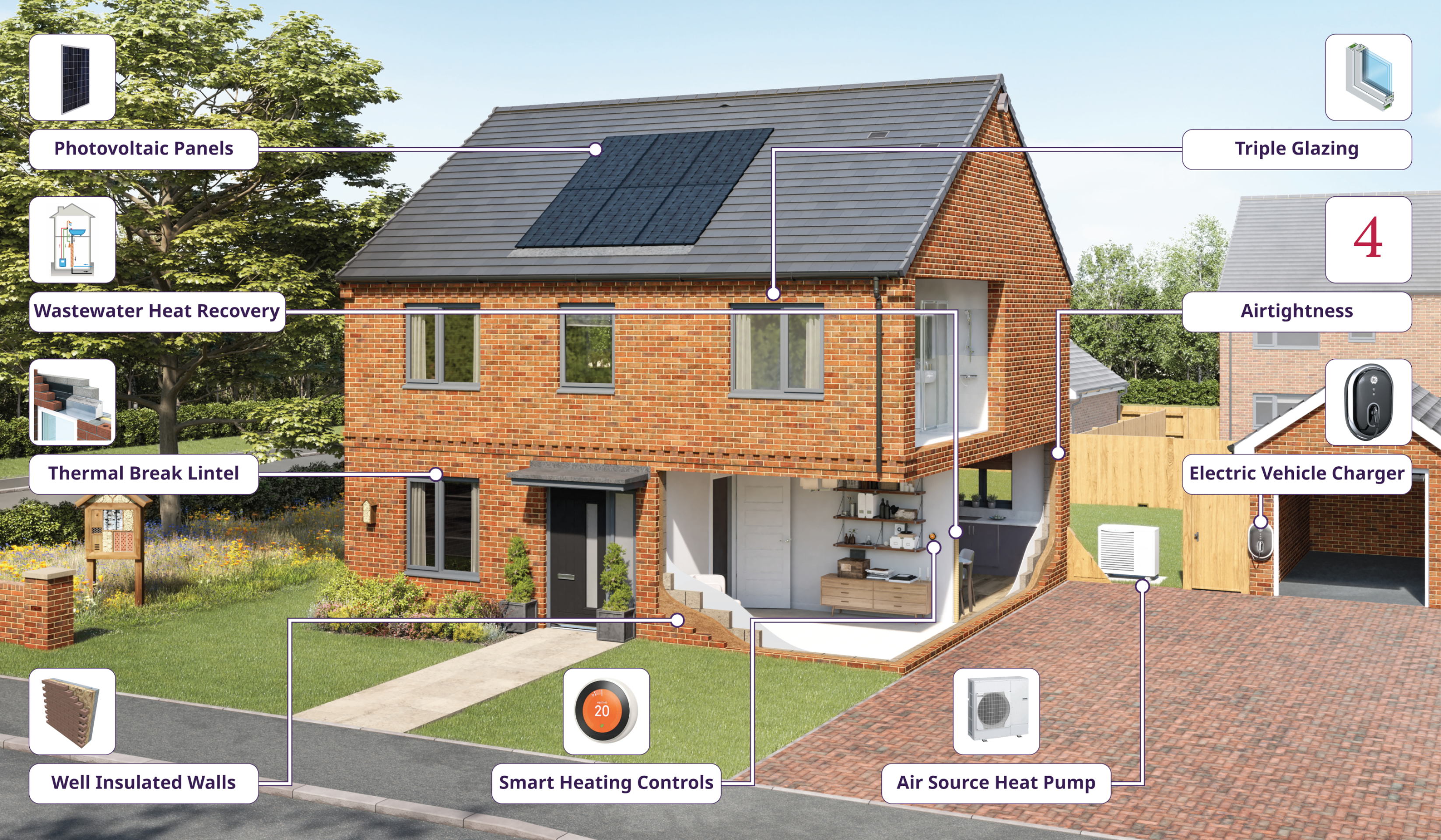
The sustainability features within a typical Taylor Wimpey home when built in accordance with the Future Homes Standard
Investing in wider community infrastructure
A key consideration with a planning proposal such as this is to ensure that local services receive the investment they need to accommodate housing growth in the local area.
The development will generate investment into key local infrastructure such as healthcare and education. Investments made will be informed by consultation carried out by Stratford-on-Avon District Council with statutory bodies such as the local NHS Integrated Care Board and the local education authority.
Any investment will be secured via a legally-binding agreement (called a Section 106 agreement) between Taylor Wimpey and the council. A proportion of the Community Infrastructure Levy (CIL) generated by the development will also be paid directly to Shipston-on-Stour Town Council for investment into local projects.

The development will generate significant funding for key infrastructure such as healthcare and education, to be determined in consultation with local stakeholders such as the NHS, the local education and highways authorities, and other statutory consultees.
Green infrastructure and ecology
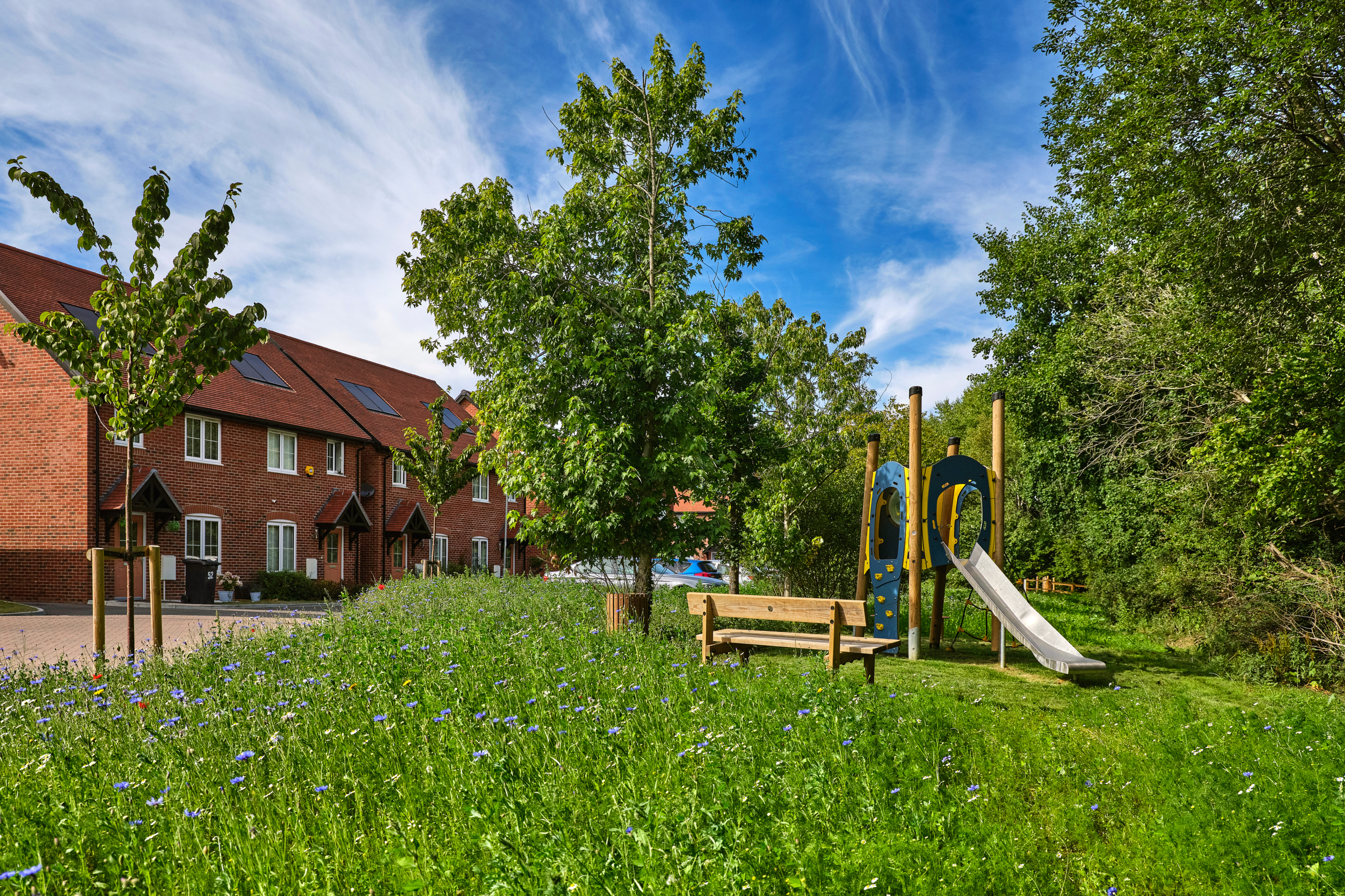
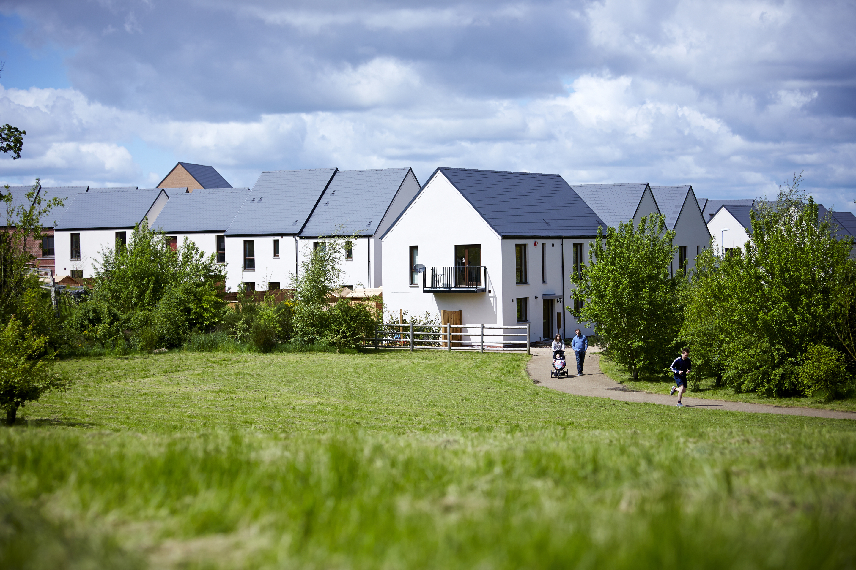
Alongside the delivery of much needed high-quality new homes, the proposed development will also see a significant proportion of the overall site area retained as open space. This will include extensive landscaped public open space, providing public recreational opportunities and areas for biodiversity enhancement.
A network of walking and cycling routes will be set within the extensive new public open space, which will also provide play areas, biodiversity areas and a potential community garden or orchard for food growing. There is also the potential to connect the new footpath network to existing public rights of way nearby.
Use the feedback questionnaire to let us know what kind of outdoor facilities you would like to see provided if possible.
Outdoor recreation at existing Taylor Wimpey developments
Ecology
Ongoing ecological investigations of the site commenced in the autumn of 2024. The results of these surveys are being used to inform the design evolution and have identified that a small number of wildlife designations are present within the local landscape, including the Midsummer Meadow Site of Special Scientific Interest (SSSI) & Local Wildlife Site (LWS).
The site itself comprises of field parcels of limited ecological value, bounded by hedgerows and trees which form more valuable habitats and are to be retained as much as possible as part of the emerging proposals.
Species interests are primarily concentrated in the valuable hedgerow habitats. The mature trees on site have been assessed as having low potential to support roosting bats. It is not anticipated that these will be impacted upon by the proposed development.
The emerging design seeks to retain and buffer the existing hedgerow network and retain existing mature trees. This, alongside significant additional landscape planting and increased tree cover across the site, has the potential to deliver significant net gains in biodiversity.
A significant proportion of the site area will be retained as public open space with significant new planting, seeking to deliver biodiversity net gain.
Building with Nature
Taylor Wimpey is proud to be a member of the Homes for Nature programme. This will see the installation of nesting bricks/boxes in every new home and hedgehog highways between gardens.

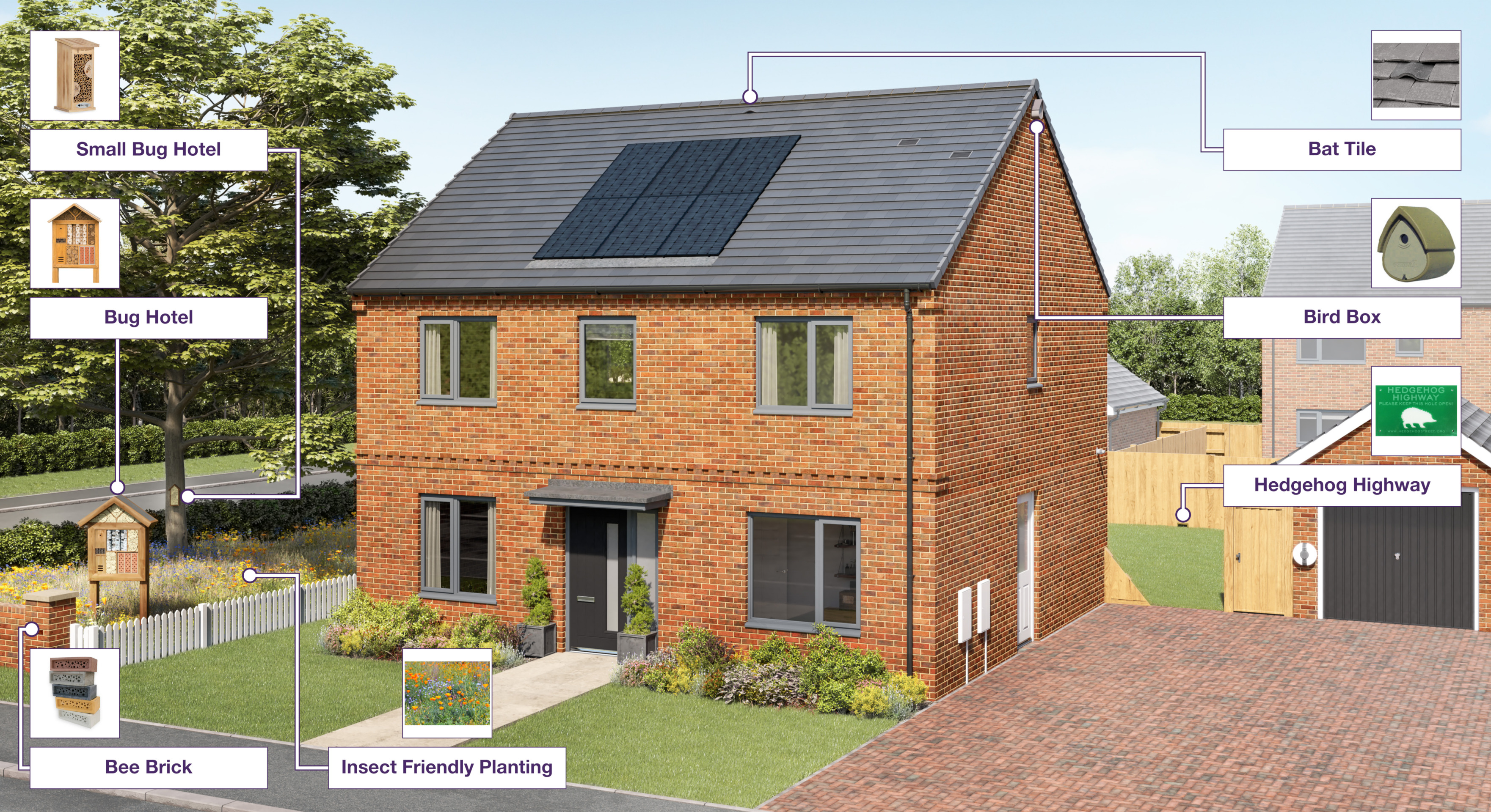
Nature interventions in a typical Taylor Wimpey home - click to enlarge
Access and highways
Access will be taken from an extension to the existing cul-de-sac from Hanson Avenue. A give way feature will be introduced within the access arrangements to suitably manage speeds as vehicles enter and exit the site.
Pedestrians will utilise the existing footway network to access the site and cyclists will continue to use the carriageway of Hanson Avenue. There are no existing road safety issues relating to pedestrian and cycle activity in the vicinity of the site on Hanson Avenue.
The site is within walking distance of local facilities including schools, shops and bus stops.
At peak hours, the site is anticipated to generate a maximum of c70 vehicle trips. It has been assessed that this would have no material impact on the operation of the local and wider highway network.
It is proposed that a number of car parking spaces will be provided within the site during construction to accommodate any potential displaced parking due to traffic management requirements. The potential is also being explored to make this arrangement permanent.
The outline application will be supported by a transport assessment, which will assess traffic impact to ensure that the development can be accommodated without significantly impacting the existing network.
The proposed give way access from an existing spur off Hanson Avenue - click to enlarge
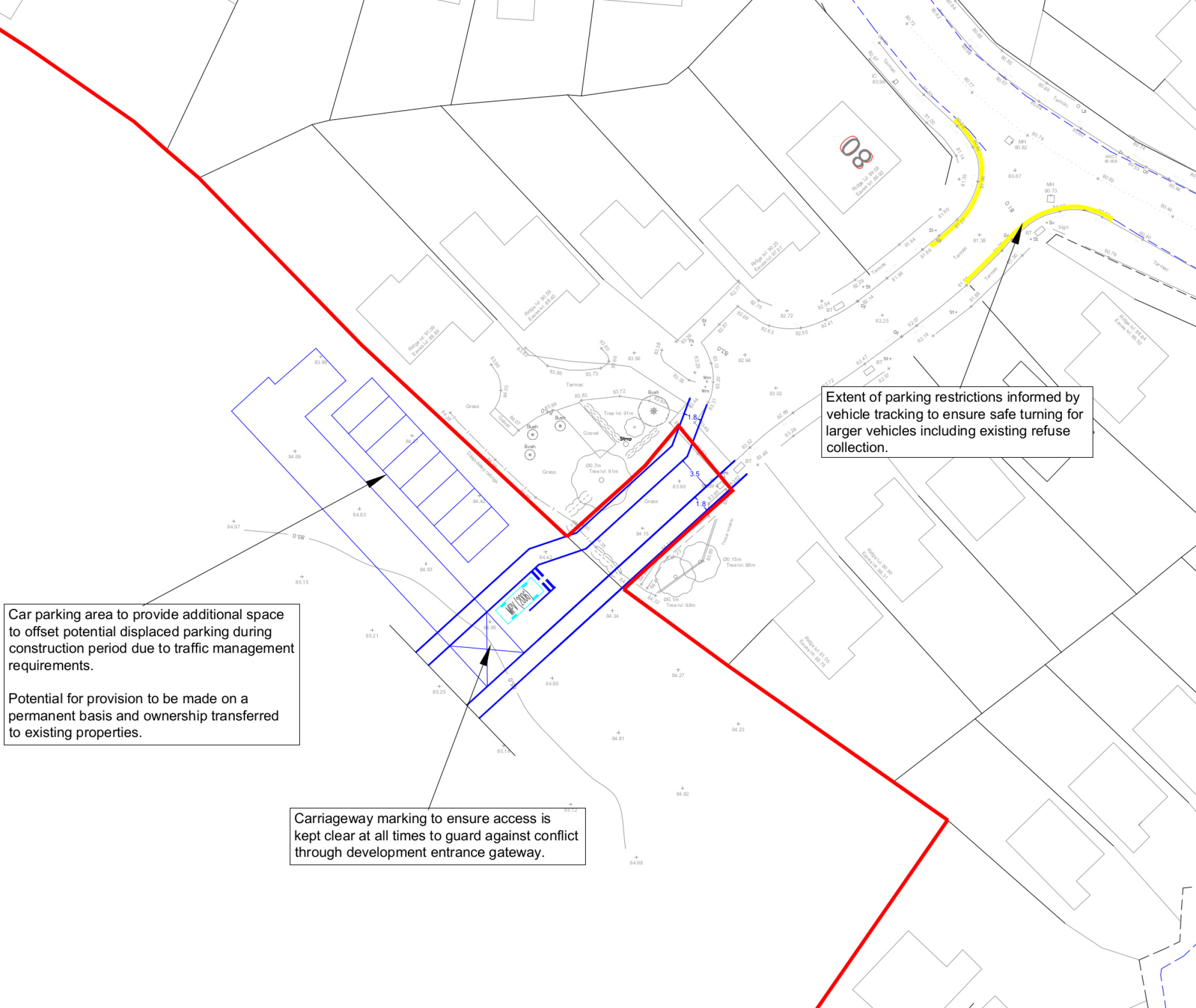
Temporary parking spaces within the site will be provided to accommodate any displaced parking during construction due to traffic management requirements - click to enlarge
Drainage
The Environment Agency’s Flood Map for Planning confirms that the whole site is located within Flood Zone 1 and is therefore at the lowest risk of flooding from rivers or streams. However, there are small localised areas of surface water flooding within the site which will need to be managed.
A sustainable drainage system (SuDS) will attenuate surface water runoff from the new neighbourhood, ensuring that surface water discharge rates do not exceed existing levels and where possible provide betterment over the existing surface water drainage on the site and in the surrounding area. The proposed attenuation area will also deliver biodiversity benefits through the provision of additional wetland habitat.
Other technical considerations
In preparing an outline planning application for the proposed development, a full suite of technical studies is being completed, including highways, flooding and drainage, ecology, utilities, noise, heritage and contamination. However, given the site’s identification within a wider preferred option for housing growth in the emerging South Warwickshire Local Plan, it is not anticipated that there will be any significant technical constraints to delivering a high quality, sustainable new neighbourhood at this site.
Your feedback
Once you have reviewed the information above and viewed the concept masterplan on our interactive map, please take a moment to complete our short feedback questionnaire.